Pista ciclabile
Pista ciclabile is an athletics track in Marsciano, Province of Perugia, Umbria. Pista ciclabile is situated nearby to the swimming pool Piscina comunale and the sports venue Palazzetto dello sport.Notable Places in the Area
Museo dinamico del laterizio e delle terrecotte
Museum

Photo: spoletoweb, CC BY-SA 2.0.
Museo dinamico del laterizio e delle terrecotte is a museum situated 1 km north of Pista ciclabile.
Localities in the Area
Civitella dei Conti
Hamlet

Photo: Ubimaior, Public domain.
Civitella dei Conti is a hamlet situated 3½ km west of Pista ciclabile.
Rotecastello
Hamlet

Photo: Wikimedia, CC BY-SA 3.0.
Rotecastello is a hamlet situated 4 km southwest of Pista ciclabile.
Morcella
Hamlet
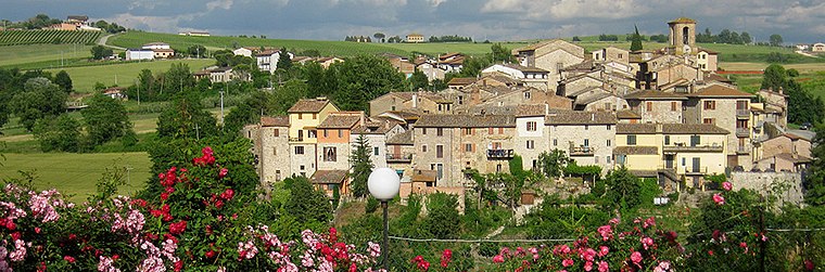
Photo: Elidebacianino, CC BY-SA 4.0.
Morcella is a hamlet situated 4½ km northwest of Pista ciclabile.
Pista ciclabile
- Type: Athletics track
- Categories: recreation area, cycle sport and sports location
- Location: Marsciano, Province of Perugia, Umbria, Central Italy, Italy, Europe
- View on OpenStreetMap
Latitude
42.90242° or 42° 54' 9" northLongitude
12.33497° or 12° 20' 6" eastOpen Location Code
8FJJW82M+XXOpenStreetMap ID
way 300620458OpenStreetMap Feature
leisure=trackOpenStreetMap Feature
sport=cyclingPista ciclabile Satellite Map
© OpenStreetMap, Mapbox and Maxar
Other Places Named Pista ciclabile
Landmarks in the Area
- Piscina comunaleSwimming pool, 170 metres northeast
- Palazzetto dello sportSports venue, 210 metres northeast
- Verde di Via LargaPark, 400 metres southwest
- Giardino MultisensorialeGarden, 530 metres north
- Parco Onorevole Alfio CapioniPark, 540 metres north
Places in the Area
- Intesa SanpaoloBank, 570 metres north
- Farmacia MenconiPharmacy, 580 metres north
- Scuola dell'infanziaSchool building, 610 metres northwest
- Centro infanziaKindergarten, 620 metres northwest
- Asilo nido Gianni RodariSchool building, 620 metres northwest
Escape to a Random Place
Discover other athletics tracks in the world.
About Mapcarta. Thanks to Mapbox for providing amazing maps. Data © OpenStreetMap contributors and available under the Open Database License. Text is available under the CC BY-SA 4.0 license, excluding photos, directions and the map. Photo: Inkey, CC BY 3.0.