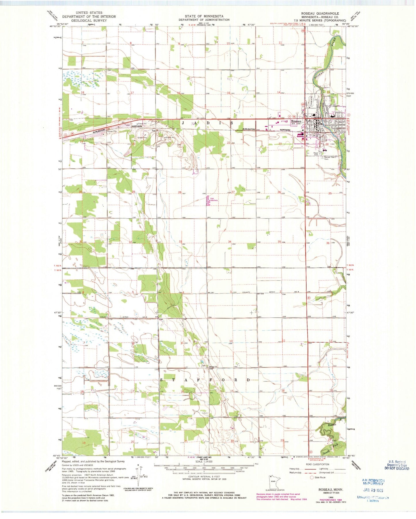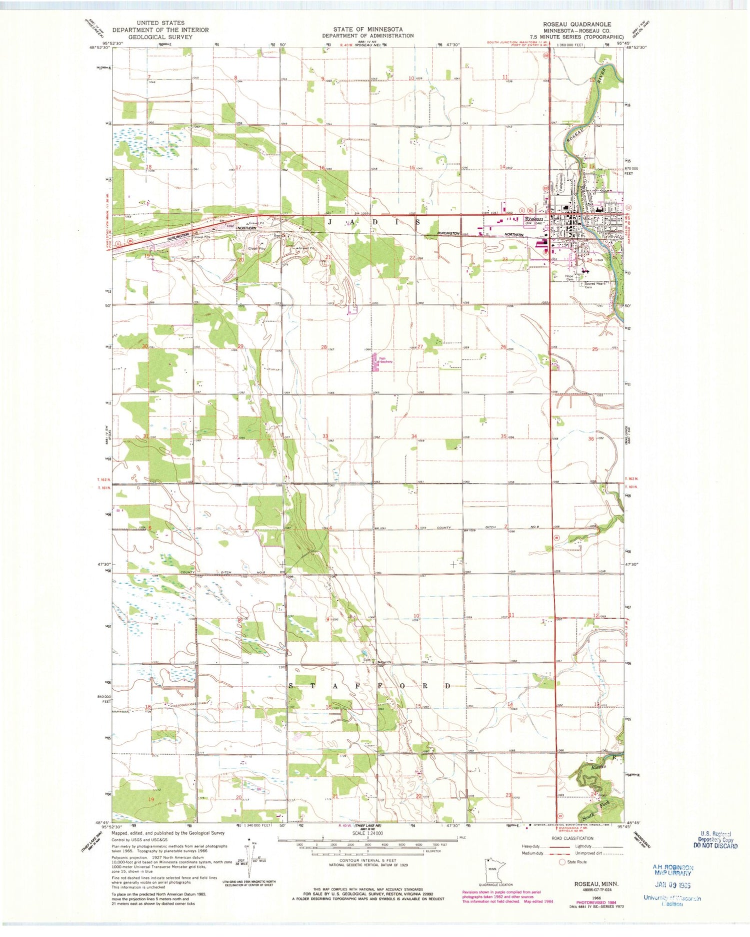
MyTopo
Classic USGS Roseau Minnesota 7.5'x7.5' Topo Map
Couldn't load pickup availability
Historical USGS topographic quad map of Roseau in the state of Minnesota. Map scale may vary for some years, but is generally around 1:24,000. Print size is approximately 24" x 27"
This quadrangle is in the following counties: Roseau.
The map contains contour lines, roads, rivers, towns, and lakes. Printed on high-quality waterproof paper with UV fade-resistant inks, and shipped rolled.
Contains the following named places: Altru Clinic, Bethel Cemetery, Bethel Church, City of Roseau, County Ditch Number Eight, Dawd Post Office, Evangelical Covenant Church, First Lutheran Church, Hope Cemetery, Kingdom Hall of Jehovah's Witnesses, KRMB-FM (Roseau), LifeCare Medical Center, Messiah Lutheran Church, Moe Lutheran Church, Norland Free Lutheran Church, Oak Manor Mobile Home Village, Rose Cemetery, Rose Church, Roseau, Roseau City Library, Roseau City Park, Roseau County, Roseau County Courthouse, Roseau County Detention Center, Roseau County Sheriff Department, Roseau County Sheriff's Office, Roseau Fire Department, Roseau High School, Roseau Oakcrest Golf Club, Roseau Police Department, Roseau Post Office, Roseau RV Park, Roseau Station, Sacred Heart Catholic Church, Sacred Heart Cemetery, Sheltering Oaks Manor, Township of Jadis, Township of Stafford, United Methodist Church, West Side Trailer Court