


It was a Halloween season storm, and it got a spooky name. Unfortunately, it would become one of the costliest hurricanes in U.S. history. I’m referring to Sandy, a late-season tropical cyclone that affected 24 states as it worked its way up the East Coast.
Ten years ago, in late Oct. 2012, a tropical cyclone was developing in the Atlantic Basin. On Oct. 22, it was named Tropical Storm Sandy.
Two days later, Sandy was a hurricane. The storm had strengthened to a Category 3 hurricane by Oct. 25, just before it made landfall in Cuba.
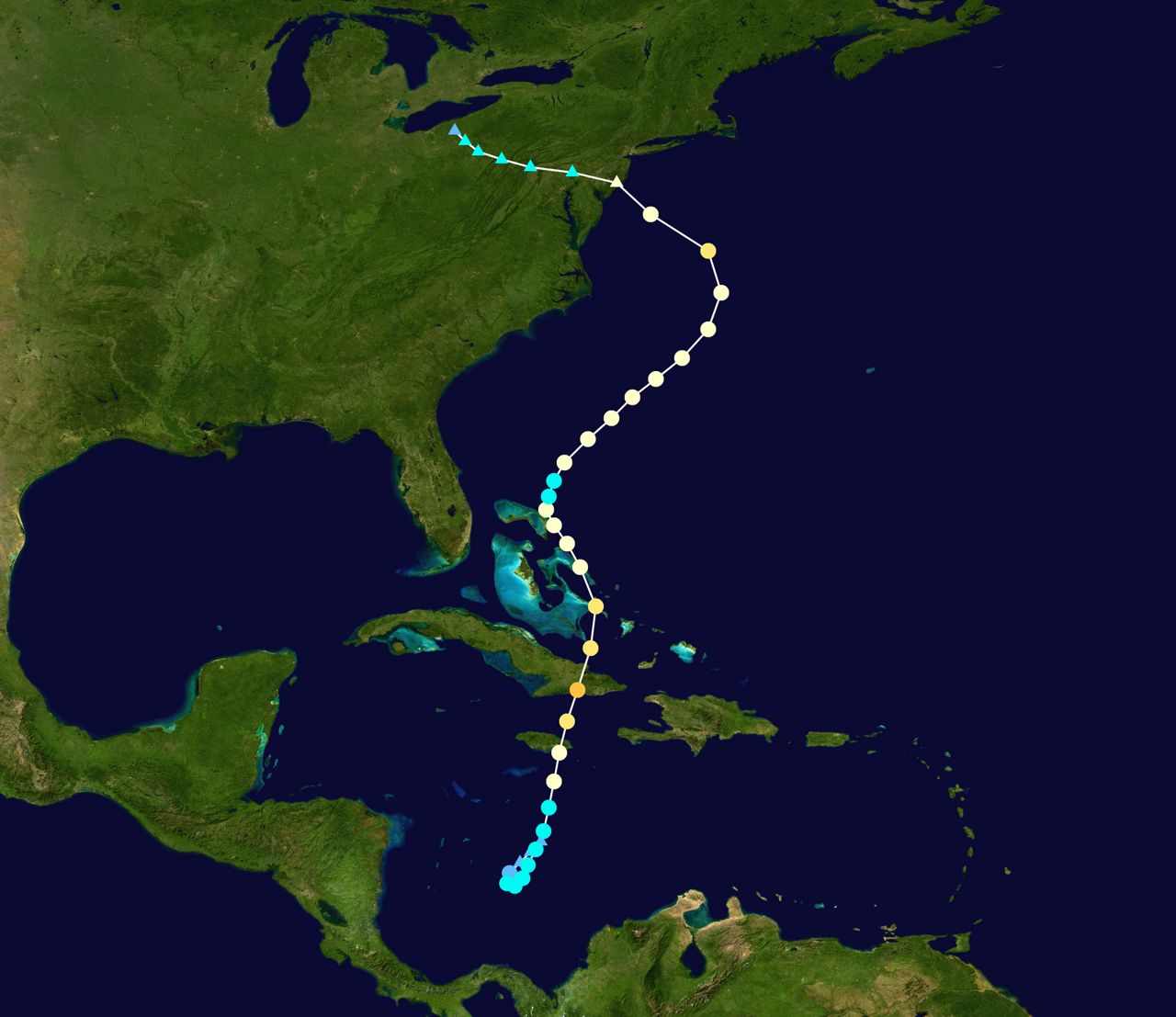
The storm then moved north and weakened. However, there was concern that the storm could develop into an extratropical system, and become a larger threat in the future. An extratropical low is one that has the elements of a warm core low (like a hurricane) and a cold core low (like most weather systems).
Since it was around Halloween, a forecaster at the Hydrometeorological Prediction Center gave Sandy the nickname “Frankenstorm,” because of Sandy gaining characteristics of both a tropical warm core low, and a typical cold core low.
Relating it to Frankenstein, a creature made of different “parts,” Hurricane Sandy was expected to gain the “parts” of two types of low pressure systems.
The name stuck. The media began referring to “Sandy” as the “Frankenstorm.”
Unfortunately, the scary sound of the name set the stage for the scary aftermath of the storm.
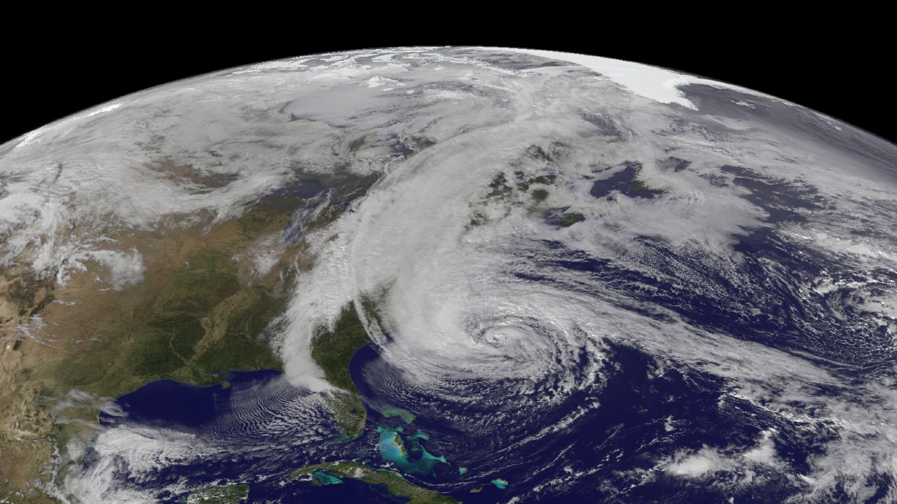
Sandy evolved into an extratropical low as cooler air was pulled into the system as it traveled farther north. Many computer forecast models had the storm turning out into the Atlantic.
Most notably, the European model showed Sandy turning more northwest over time and impacting the Northeastern United States, and that’s what it did.
With warm core tropical lows, the strongest winds of the storm are close to the center of the system. As the storm became extratropical, that strong wind field got much bigger. Tropical storm-force winds expanded into an area over 1000 miles wide.
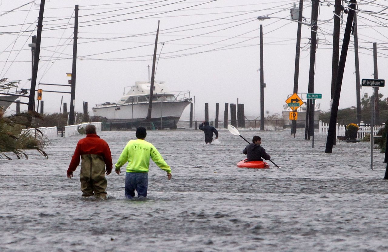
Unfortunately, many felt that Sandy wasn’t that dangerous because it was "only" a Category 1 hurricane, and many did not take the necessary precautions as the monstrous storm approached the Northeast.
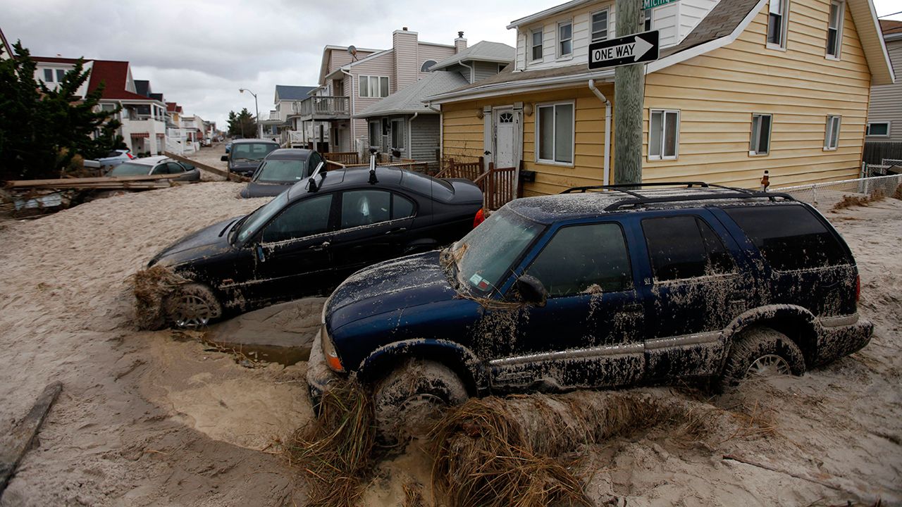
On Oct. 29, 2012, Sandy made landfall in Brigantine, New Jersey with 80 mph winds. However, due to the much larger wind field with the storm, a greater area was impacted not only by very strong winds, but also by a great storm surge that ranged from 7 to 14 feet along the coast.
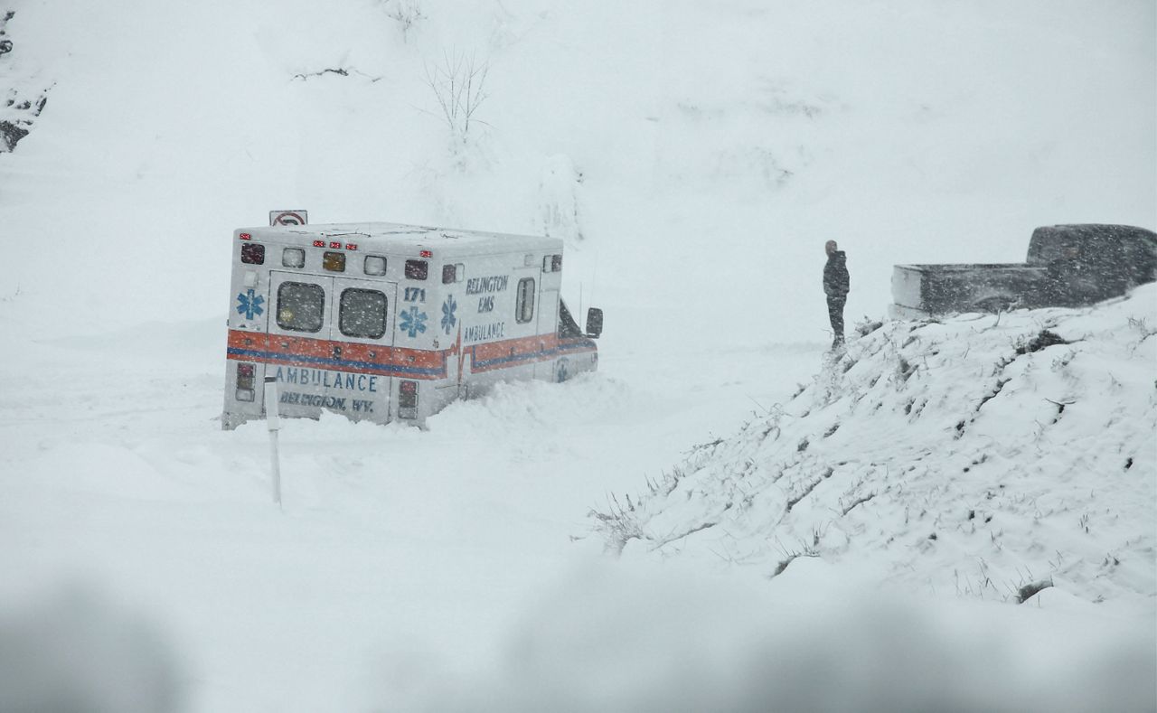
To add to the legend of the “Frankenstorm,” Sandy would pull more cold air into itself and for some in the central Appalachians. The once-hurricane became a winter storm, dropping anywhere from 2 to 3 feet of snow at higher elevations.
The storm lived up to its nickname and became a weather monster, the worst storm of the 2012 Atlantic hurricane season. There were 233 fatalities because of the storm, 157 of those in the United States.
The damage caused by Sandy topped out at over 68 billion dollars, with 65 billion dollars worth of damage in the U.S. alone. At the time, the only hurricane that had caused more damage in the U.S. was Hurricane Katrina.
Today, Hurricane Sandy is referred to as “Superstorm Sandy.” With the amount of destruction it caused, that name certainly fits.
Though, when you think about it, with the transition to an extra-tropical low, with the sheer size of the storm, with the idea that a hurricane became a winter storm for some, Sandy lived up to the name “Frankenstorm.”
Our team of meteorologists dives deep into the science of weather and breaks down timely weather data and information. To view more weather and climate stories, check out our weather blogs section.