Hiking Arches National Park’s Devils Garden in Winter
Arches National Park is a strange world of red slick rock, loops and arches of rock rising out of the desert, and a confusion of eroded rock fins and spires. The absurd natural beauty of Arches has led to it becoming one of the most popular national parks in the country. Arches was once home to the well-known nature writer, Edward Abbey, who worked as a park ranger when Arches and Canyonlands were still national monuments. His time in the park provided the material for his celebrated book “Desert Solitaire.” He described the landscape of Arches as “league on league of red cliff and arid tablelands, extending through purple haze over the bulging curve of the planet to the ranges of Colorado — a sea of desert.”
Arches National Park was very different in Abbey’s time. With only rough roads providing access to the park, a key aspect of Abbey’s experience in the park was the solitude of the desert landscape. Today around 4000 people might visit the park on a summer day and the line of cars trying to get into the park can stretch to a mile long, forcing rangers to close the park to additional visitors.

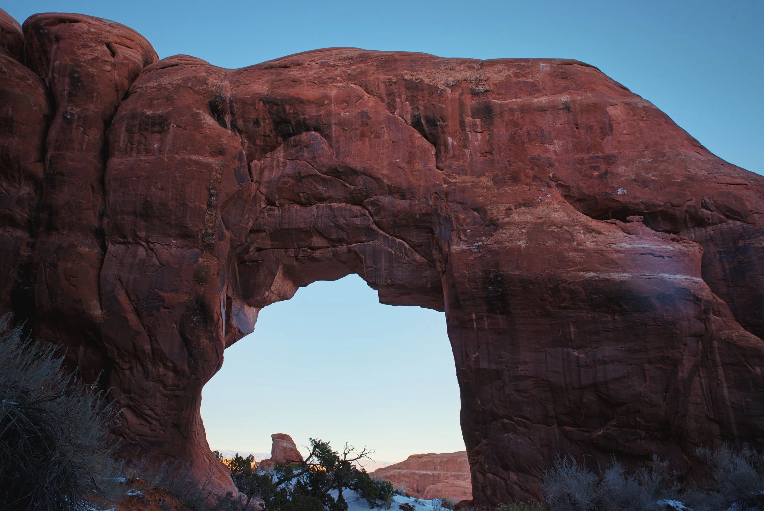
A “sea of desert” witnessed through the opening of Partition Arch.
We enjoyed the solitude we were able to find on our winter hike in Devils Garden.
If you want to get a sense of Arches as Abbey experienced without embarking on an off-trail backpacking trip into the wilderness of the national park’s back country, the Devils Garden trail is probably your best bet. If you can make it to Arches National Park between December and February, you can experience the park with as few as 200 other people.
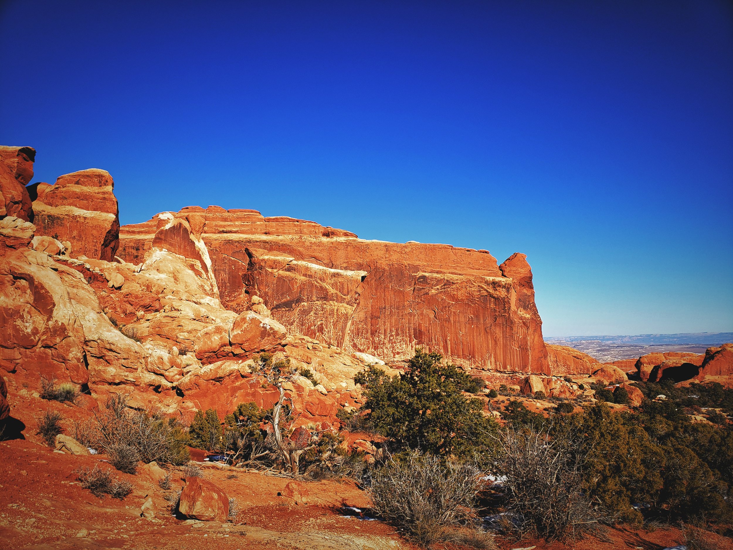
We visited Arches National Park in mid-December, and we made a point of spending a day hiking the Devils Garden Loop. Arches has the highest concentration of natural stone arches in the world, with over 2,000 arches over three feet tall in the park’s boundaries. There are seven arches that you can approach up close along the Devils Garden Trail, along with a high concentration of sculpted rock fins and a number of other interesting rock formations to explore.

A map at the trailhead shows the arches that can be accessed along the Devils Garden Trail.

Winter transforms the stone in Arches National Park.
The loop trail itself is 7.2 miles, but it ends up being longer than that because of the many spur trails that lead you to the arches along the trail. With hiking every spur trail, at the end of the hike our GPS watches told us that we had actually walked 9 miles.
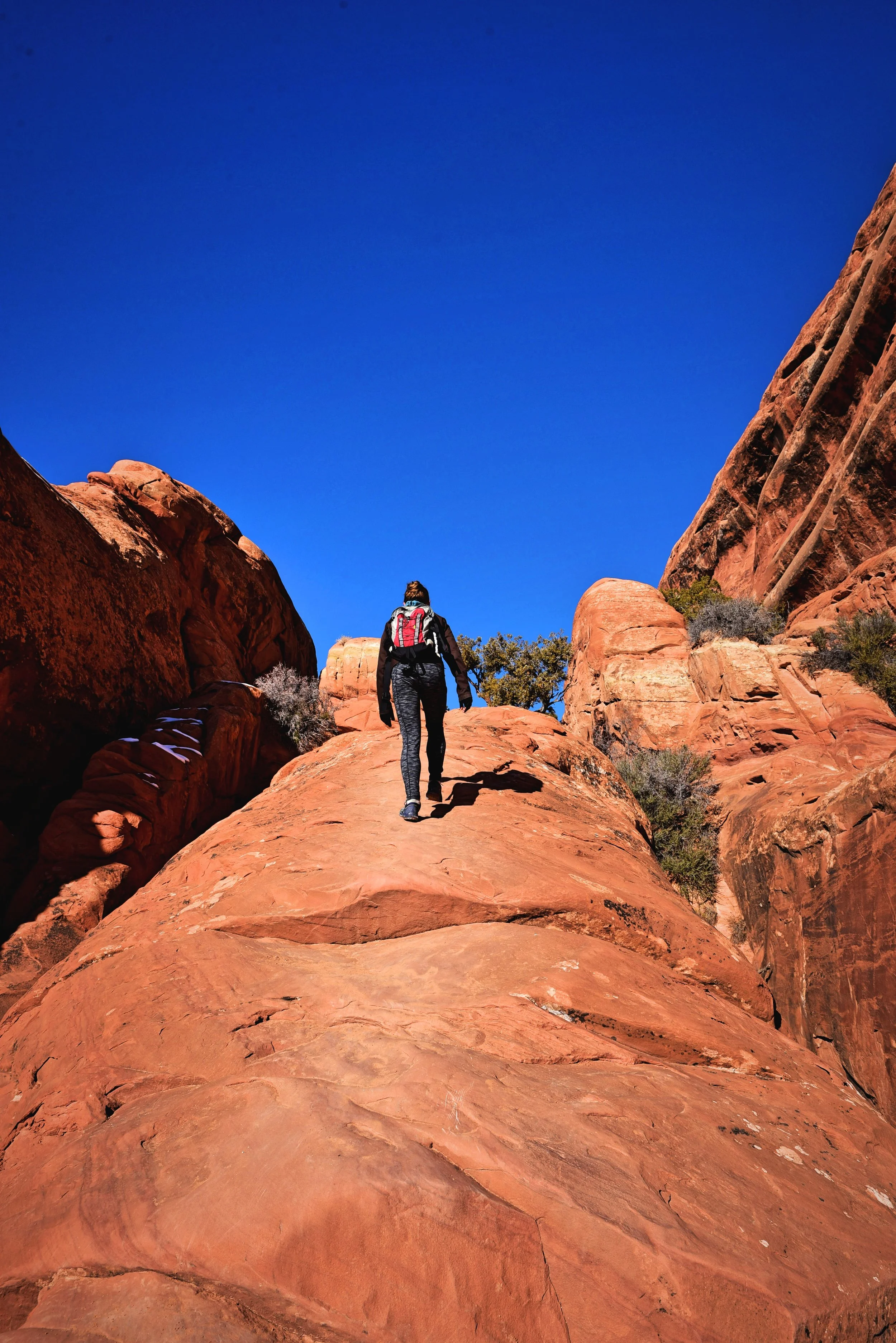
The trail begins easily taking you between massive fins of sandstone rising inexplicably out of the desert’s surface on a flat but loose sandy trail. Early in the hike, you can visit Pine Tree and Tunnel Arch on your way out, but we saved these short spurs for the end of our hike.
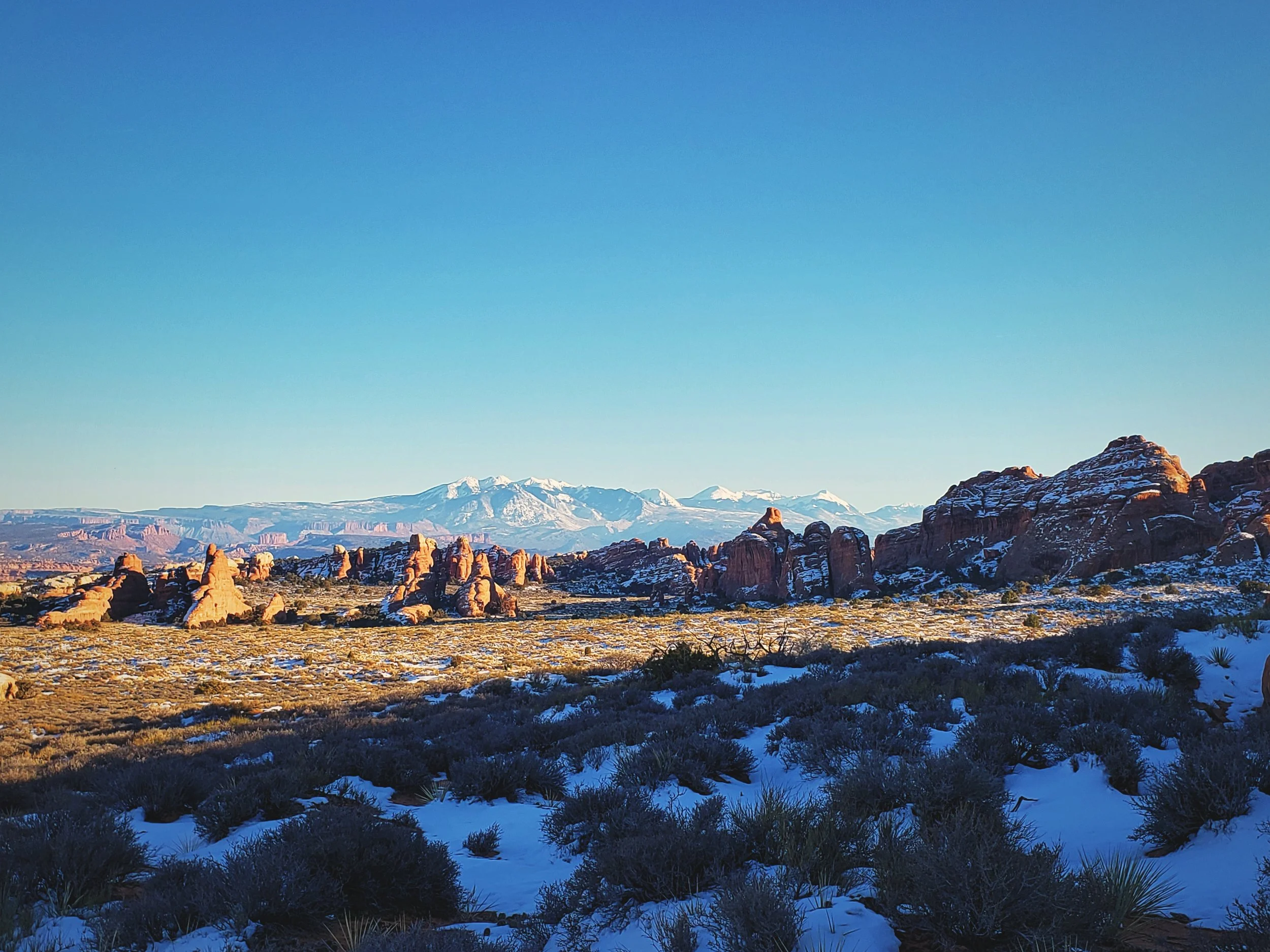
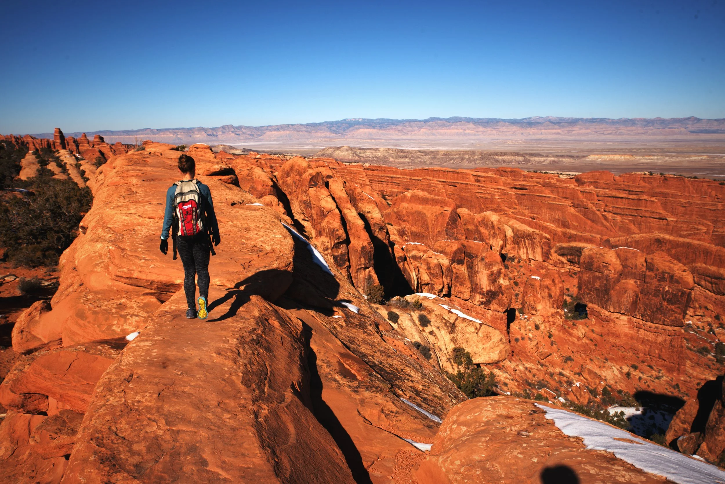
Fins of sandstone rising from the desert with the La Sal Mountains as a backdrop.
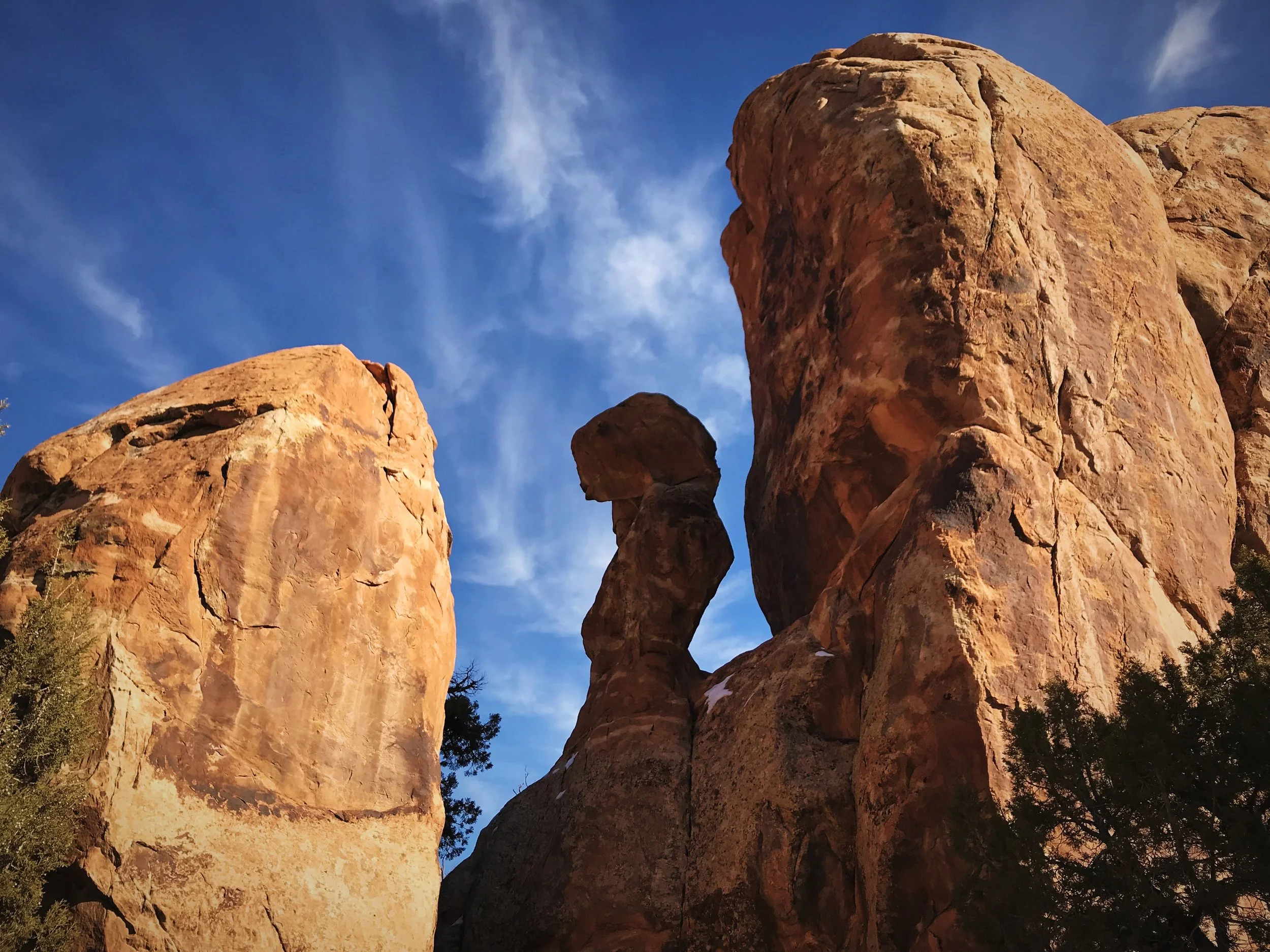
A curious rock formation early in the hike along the Devils Garden Loop.
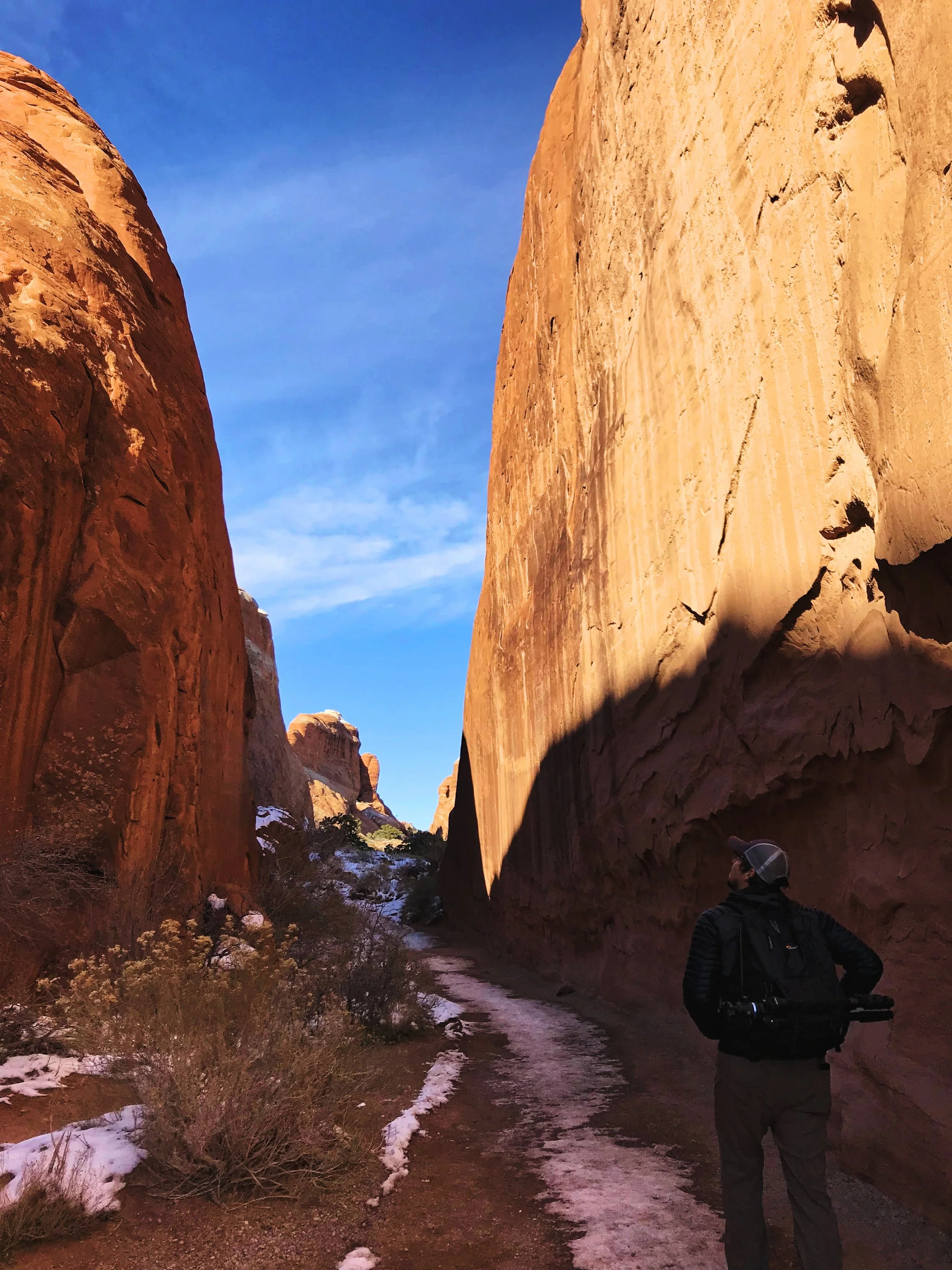
Ian walks between two walls of sandstone on the way to Landscape Arch.
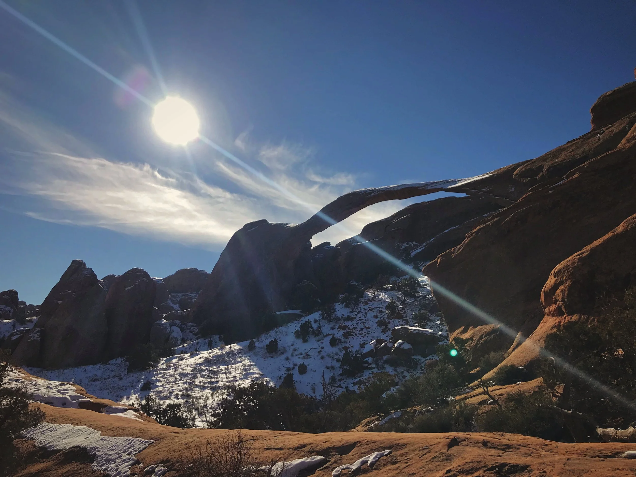
Landscape Arch
In less than a mile, you arrive at the very wide but miraculously thin Landscape Arch. The slender arch spans over a light opening 306 feet wide, making it the longest arch in North America and one of the longest in the world. Even though Landscape Arch is one of the lengthiest arches, it is barely more than a delicate sliver of rock. At its center it’s only about six feet thick. If you don’t have time or the ability to hike the entire Devils Garden Loop, you could hike out and back to Landscape Arch and it would be about 1.6 miles.
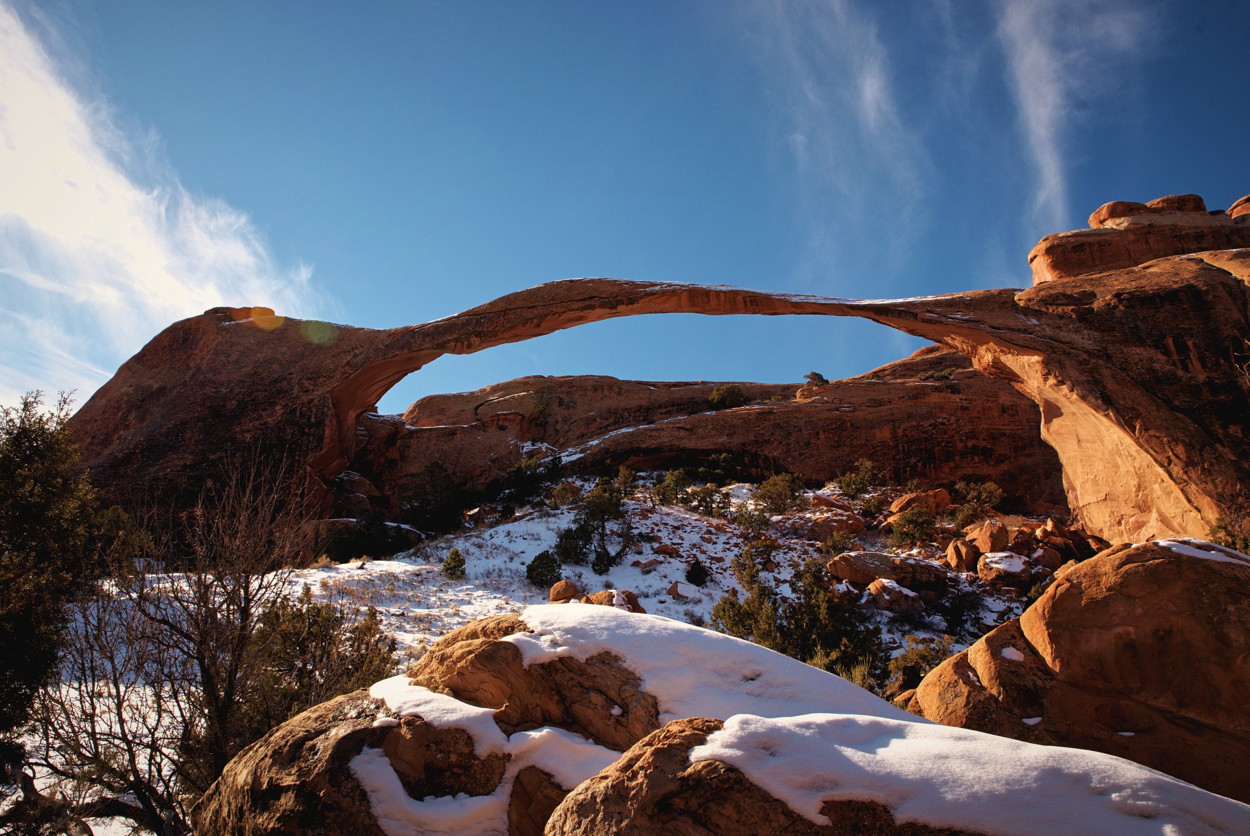
Landscape Arch is the longest arch in North America.

This is as close as you can get to the arch these days.
Pieces of Landscape Arch fell from beneath it in the early 90s, nearly falling on a group of people picnicking below who moved after hearing loud cracking noises. Since then visitors have not been able to walk underneath the arch. You can only look on from a fenced viewing area along the trail.
Though somehow Landscape Arch manages to hang on, other arches in Devil’s Garden have fallen in recent years. Wall Arch, a seemingly much sturdier arch which once spanned 71 feet, crashed to the ground in August 2008.
The trail to Landscape Arch is a really easy short hike.
Landscape Arch seems to defy gravity, it’s that thin!
Partition and Navajo Arch
After Landscape Arch, the trail becomes a “primitive trail” and is more challenging. We continued to Partition and Navajo Arch, which are nearby as the crow flies but they are fair distance further up the trail, because you kind of have to double back to view them. From Landscape Arch, you climb a somewhat narrow fin of slickrock up the trail to reach a shelf above the first part of the trail. But fortunately the slope of the slickrock is shallow and easy enough to walk up, and it’s wide.

Walking up the slickrock slope to access Navajo and Partition Arch.
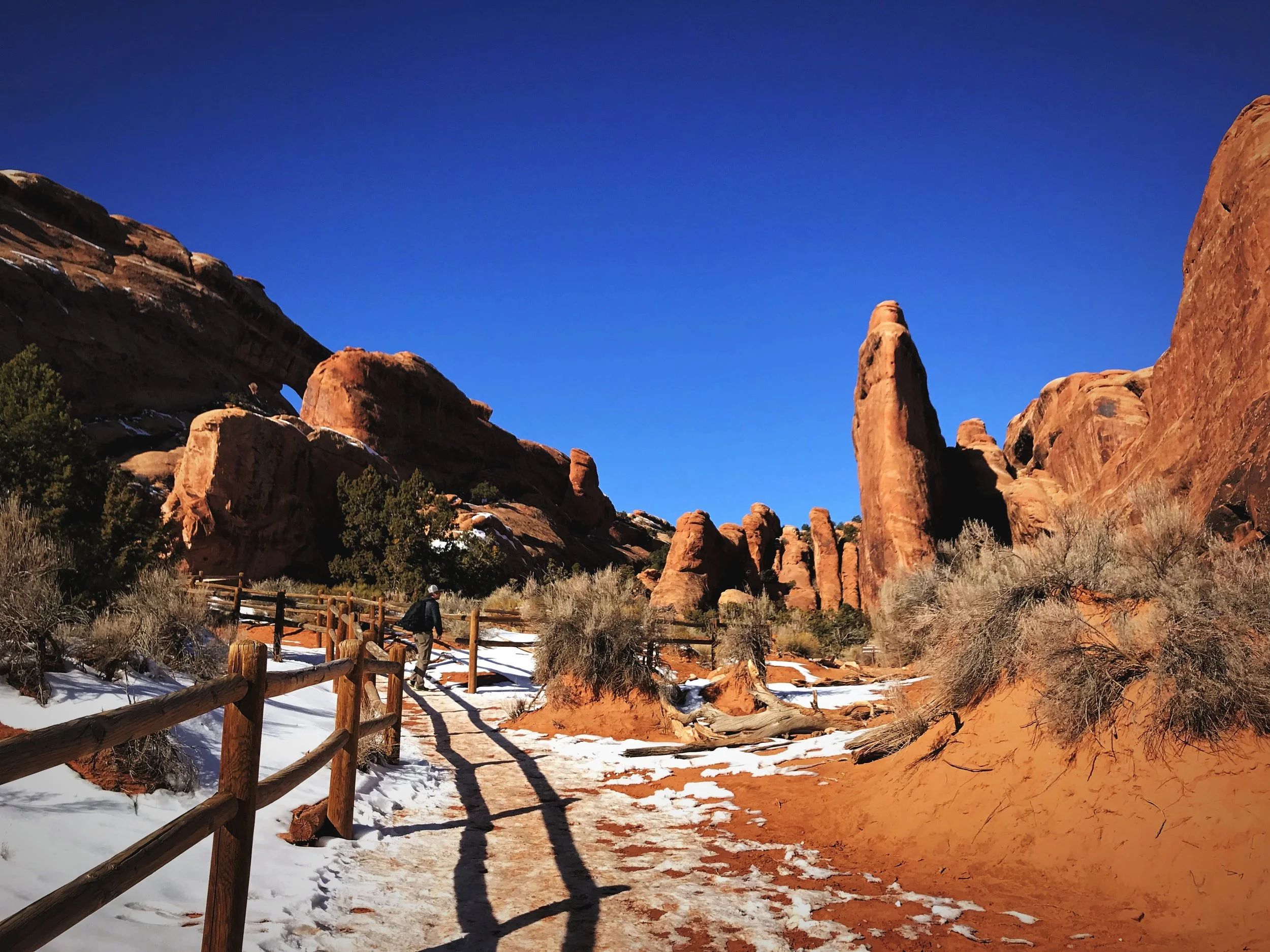
Even without the seven arches, Devils Garden is amazing on its own.
The spur trails to Navajo and Partition Arches add about a mile to the hike’s distance, but visiting these arches is so worth it. We started by checking out Navajo Arch, which is tucked right up against another wall of sandstone. The low, wide arch has an almost cave like feeling. You can walk underneath the arch and into this shadowy “cave.” Looking out from under, a gnarled Utah Juniper is perfectly framed by the curve of the arch.

Navajo Arch has a cavelike feeling when you walk under it.
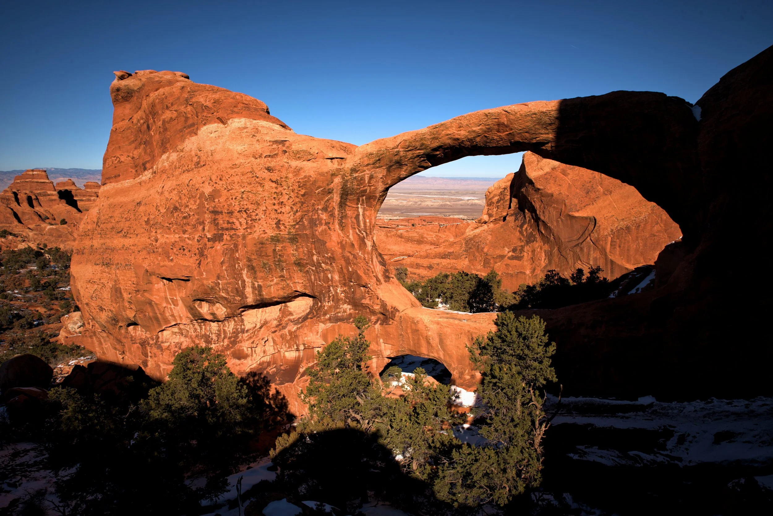
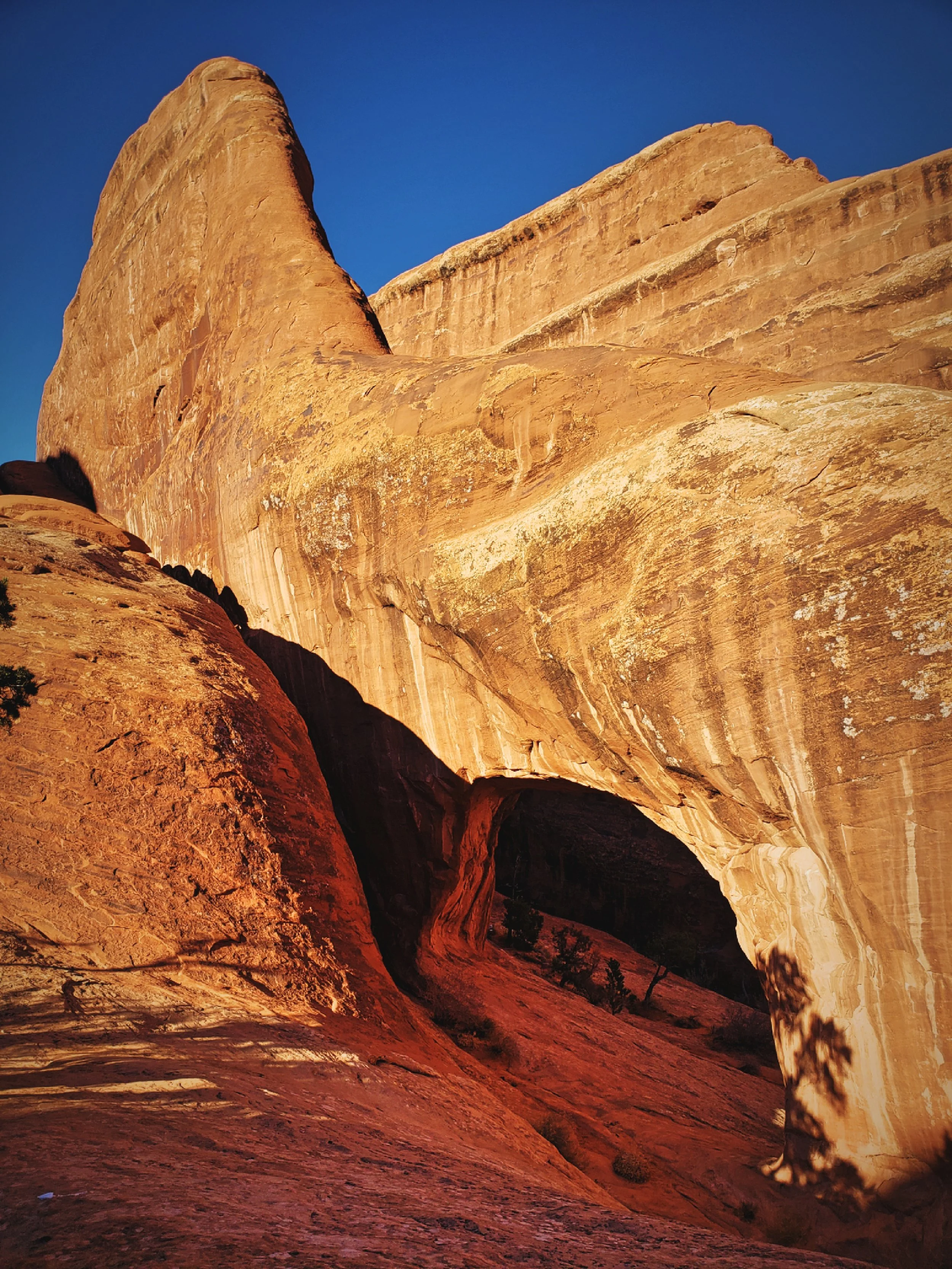
Partition Arch is above Landscape Arch. It stands alone within a wall of sandstone well above the trailhead. Its opening frames a view of the landscape of Arches National Park, and even the La Sal Mountains far in the distance. Besides the arch, there is a small window next to it as well. You can walk underneath Partition Arch to pose for a photo, and we would highly recommend it. But be careful, because on the other side is a pretty steep drop off.
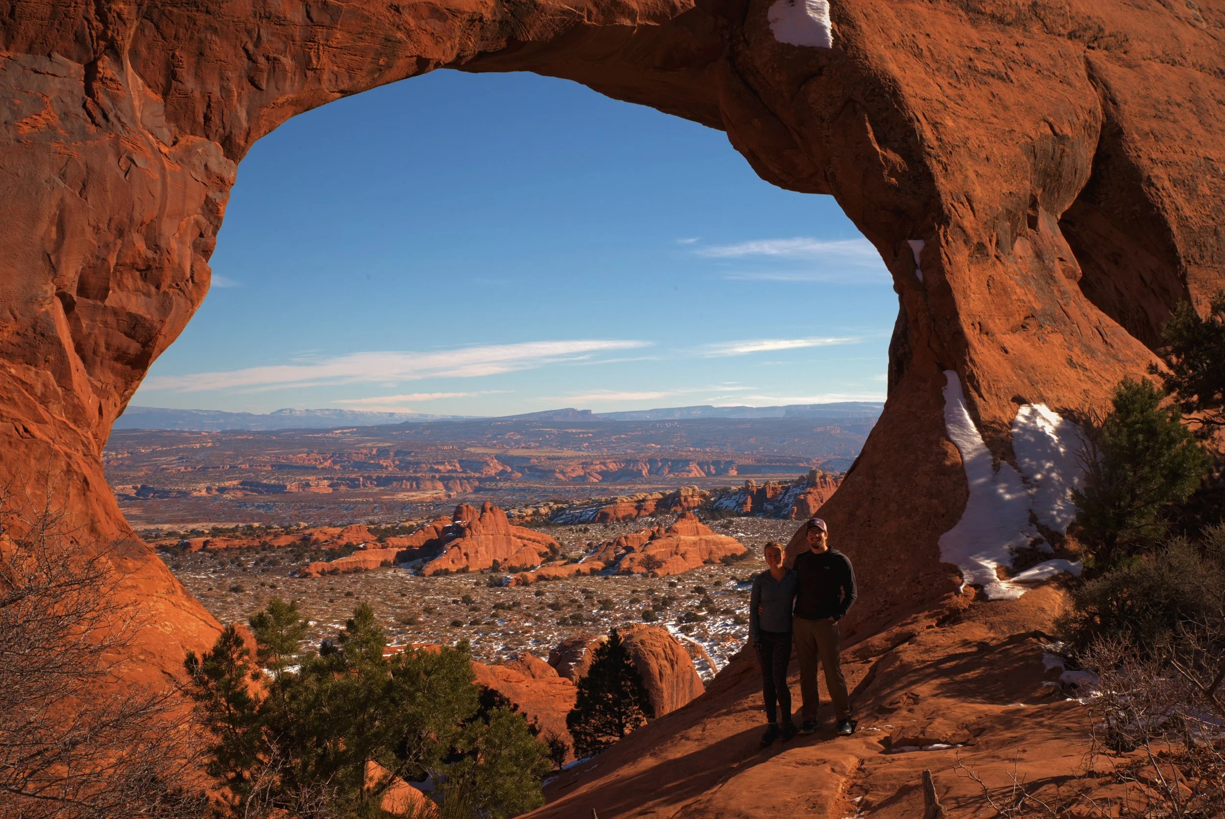
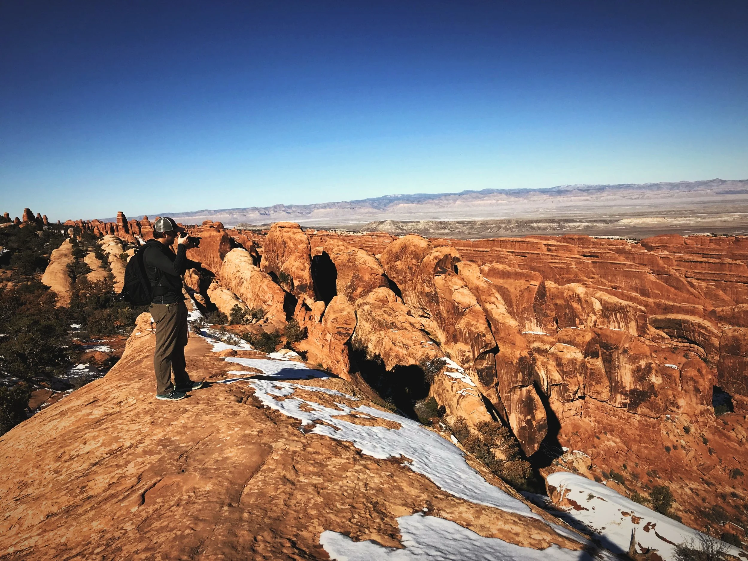
Posing for a photo in front of Partition Arch.
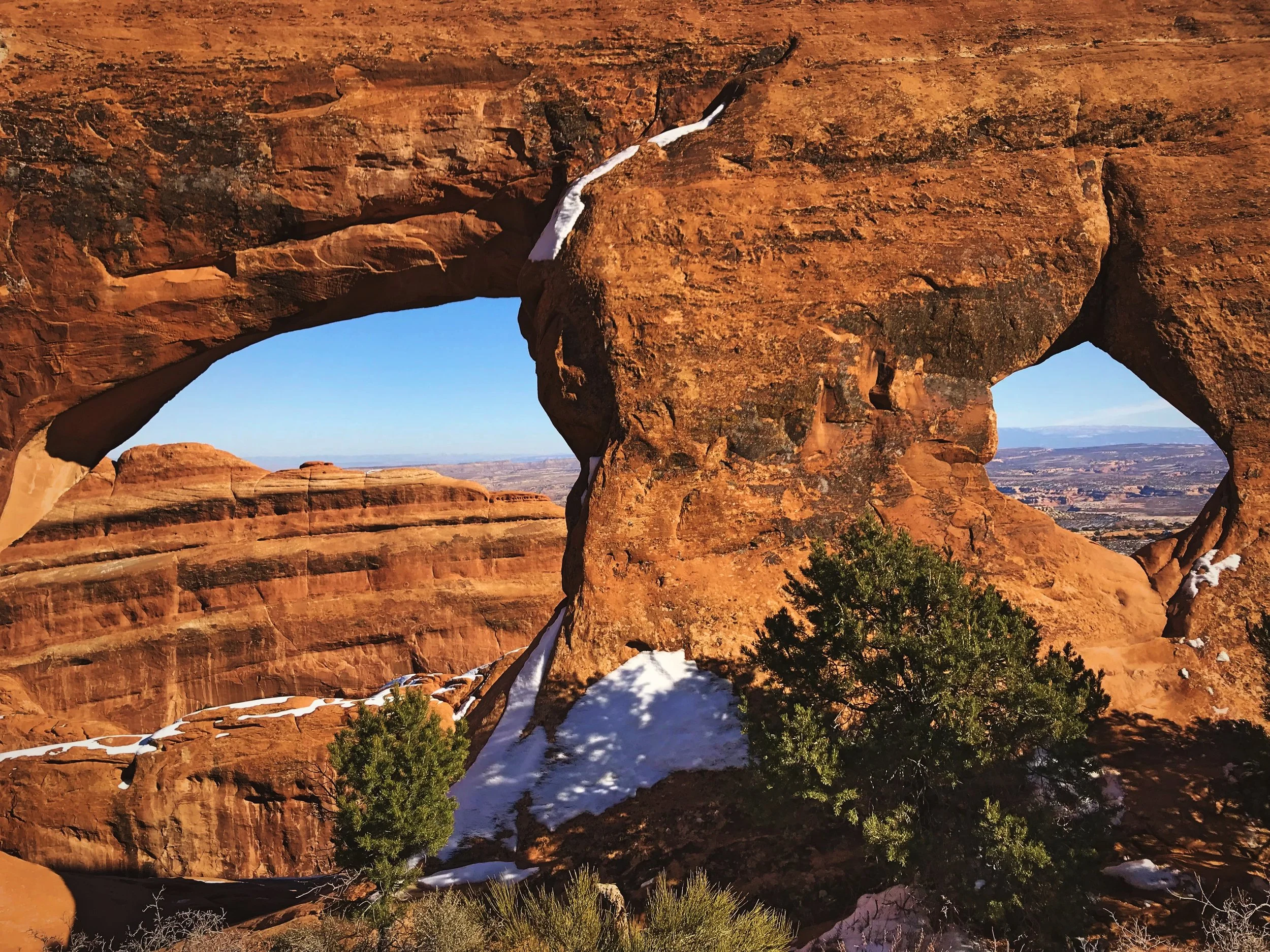
Besides Partition Arch there is also a small window next to it.
Double O Arch
From Partition Arch and Navajo Arch, it is a more technical and strenuous hike to reach Double O Arch. The trail crosses a very narrow fin of sandstone, with drop offs on either side, but it’s not very high off the ground. While traversing the fin, you get great views of the Valley of Fins—layers and layers of orange sandstone and purple shadow stretching into the distance. You can spot the aptly named Black Arch, which is just a dark hole in one of the fins. A slight amount of scrambling is required to descend from the narrow fin the trail follows.

Ian walks along the fin that the Devils Garden Trail follows.

Ice and snow made reaching Double O Arch a bit tricky.

To get down from the fin, follow the trail signs for an easy descent.
After the ridge, you have to scramble through another area of rock that is very narrow ledge along a slickrock slope. The rock was covered with ice so we tried to walk above the ledge on the iceless slope. Unfortunately there was a huge crack that Ian was able to cross but my legs weren’t quite long enough to cross it comfortably. Another hiker was watching us offered to toss us his traction devices, that’s how sketchy the ice was. If you’re taking on this trail in winter, micro spikes for your shoes would be a huge help! We ended up taking a lower route on the sandstone slope which required passing along a narrow snow covered ledge and squeezing around some huge boulders. But fortunately the snow was not slippery like the ice on the ledge that the trail technically follows. Beyond that area of intense, icy scrambling, it was easy walking to reach Double O Arch, and we found that the rest of the primitive trail was actually a lot easier from that point on.
Standing below the incredibly large Double O Arch.
Ian scrambled to this point so he could capture this shot of the full stacked arch.
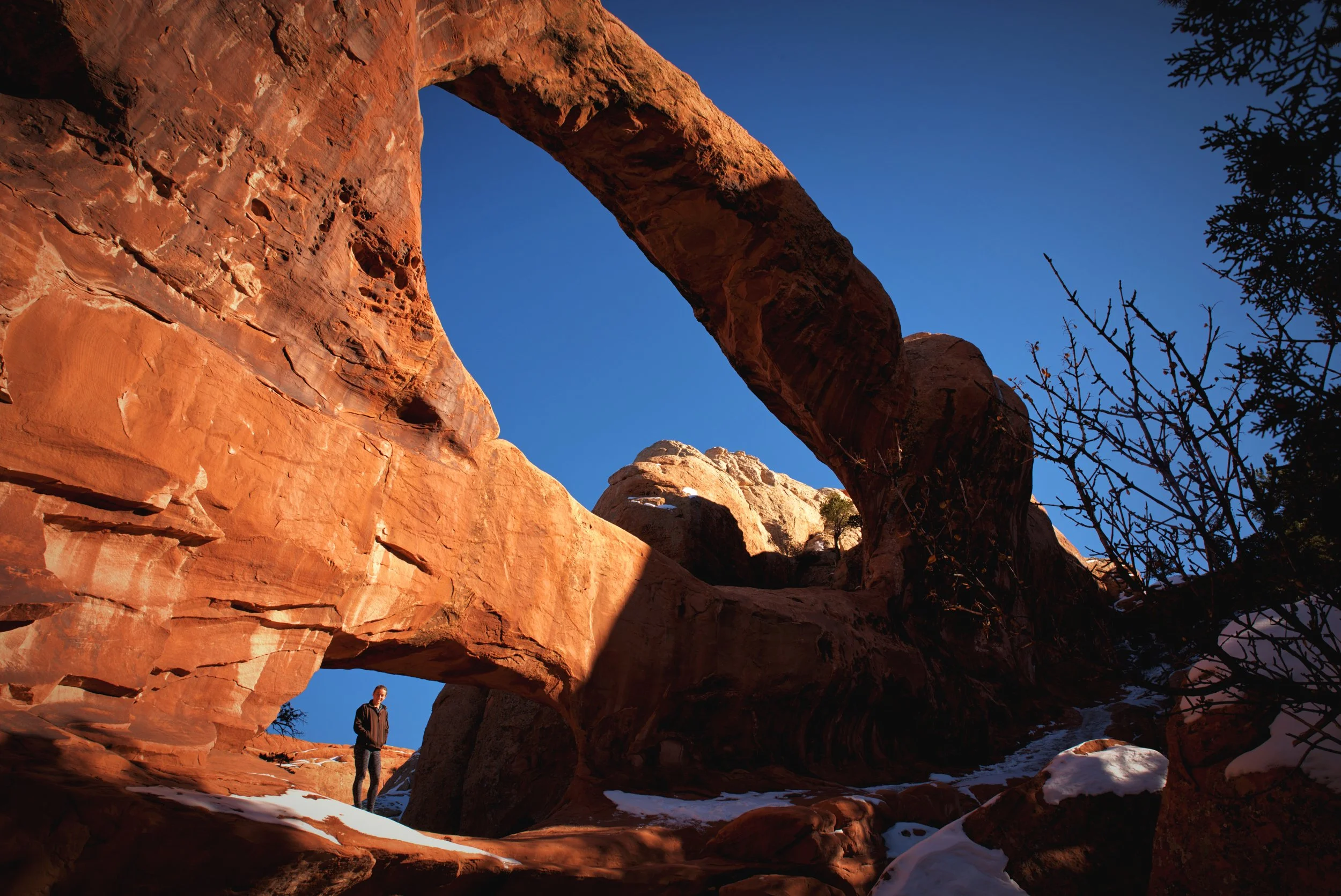
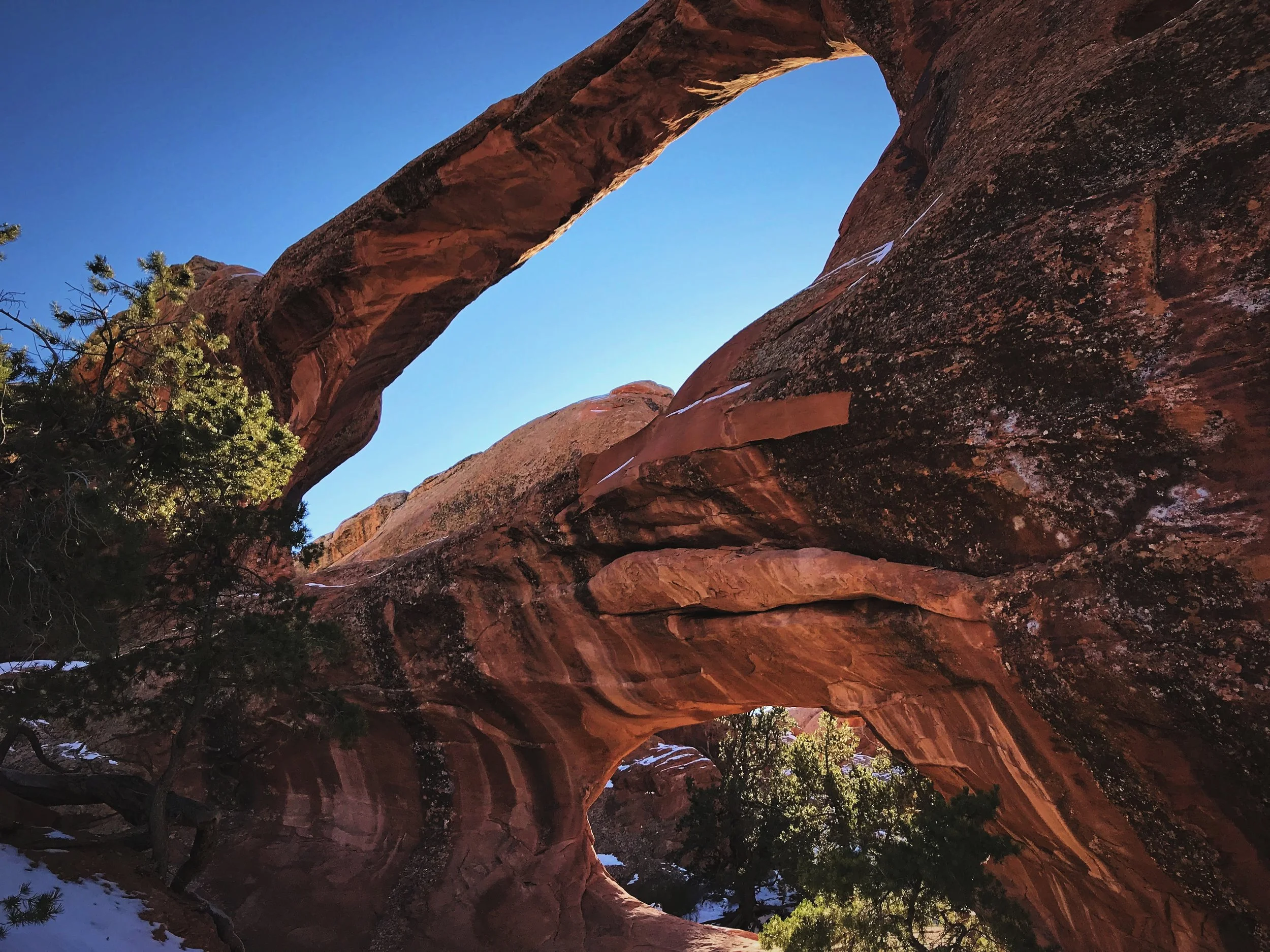
Double O Arch is actually two arches stacked improbably one on top of the other. Once we arrived, we clambered up beneath the lower arch, which is a very circular o-shaped opening surrounded by thick rock on all sides. The upper arch is a narrower span of rock, and it extends across a wider expanse with an opening more like an oval. The entire formation is stunningly tall. We had the arch completely to ourselves. We had recently finished a major repair on our van, replacing our timing chain on our own, so we took the opportunity to pop a bottle of champagne at this beautiful spot (check out blog post, “How to Repair Your Camper Van or RV while Living on the Road.”)

The fins beyond Double O Arch.
Double O Arch is definitely one of the most impressive arches in the park.
Dark Angel
After Double O Arch, the trail seemed like it became much more challenging to follow. You really have to keep your eye out for the cairns (piles of stones) that have been set up to lead you along the trail. Don’t follow other people’s footprints, because apparently a lot of people wander off trail and go the wrong way. This challenge was only intensified by the snow that was blanketing the ground in this area when we were hiking.
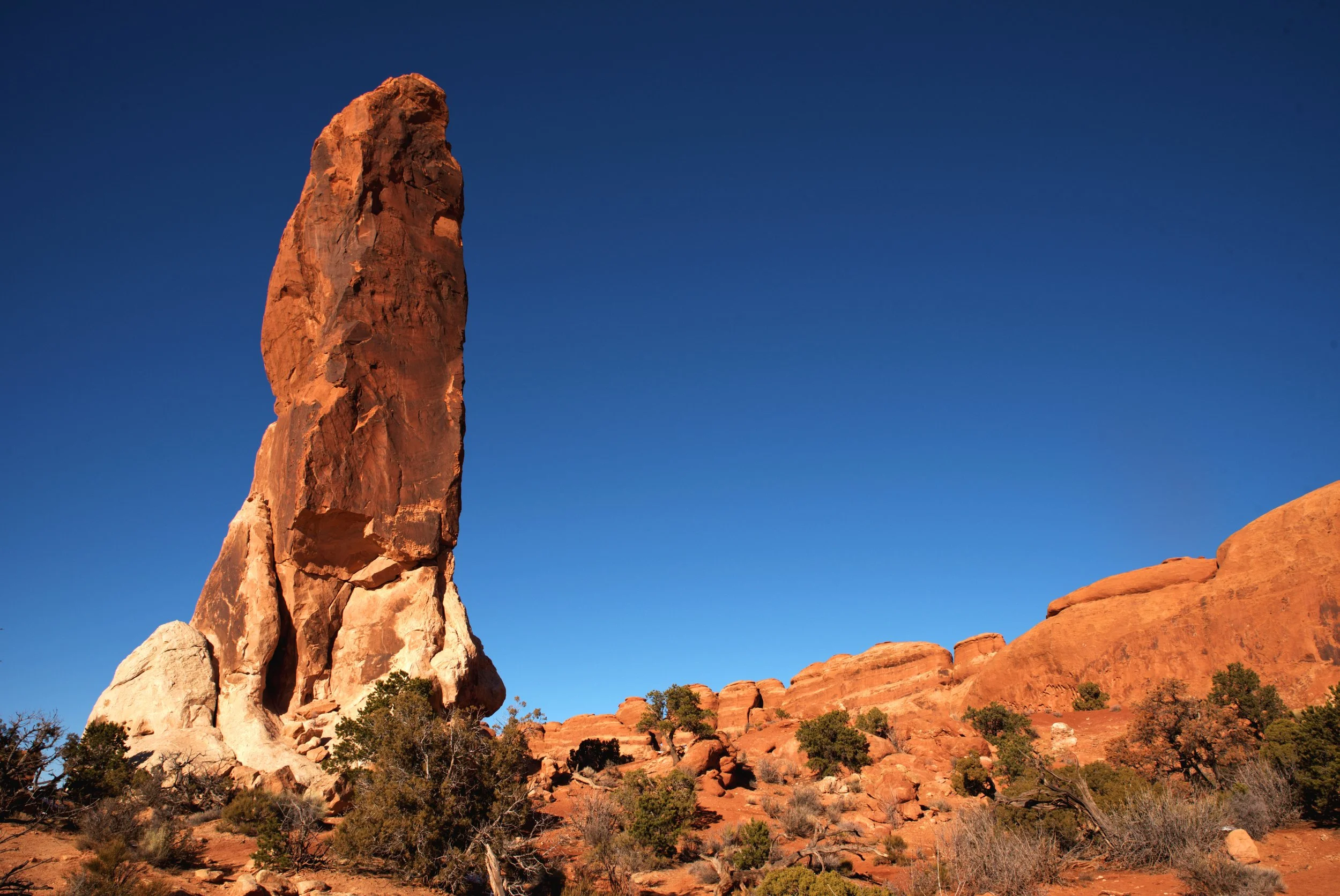
Dark Angel is tall stained formation that rises alone out of the desert.

The primitive trail beyond Double O Arch is a bit more faint that the earlier trail.
On our way to next the stop, which was at the end of a half mile spur trail, we got quite far off the trail in an area of sand and juniper brush due to deep snow obscuring the trail. At the end of this spur trail is a sandstone formation called Dark Angel. Prior to this hike, we had no idea what the Dark Angel formation would look like. We just saw the trail marked with the evocative name “Dark Angel,” and we knew that we had to check it out. The Dark Angel turned out to be a tall, narrow obelisk of stone that has been stained by a desert varnish. This smooth, dark varnish is a layer of iron or manganese on the surface of the rock. American Indians have often used the desert varnish on rocks as a canvas for rock art (to see some pictures of these type of petroglyphs check out our blog post about Delicate Arch or about Grime’s Point in Nevada.)
Primitive Trail
Back on the Devils Garden Primitive Trail, we began crossing areas of deep sand alternating with areas of slick rock. On some areas of the primitive portion of this hike, you go up and down some narrow sandstone fins, including descending some steep slickrock slides, but that’s about as difficult as it gets. A pair of trekking poles could be really helpful for this part of the hike. Much of the trail is just walking in washes though.
Ian follows a helpful arrow up and over a slickrock slope.
The primitive portion of the Devils Garden trail goes past countless sandstone fins.

This opening in the distance is a fun little arch called “The Top Story Window.”
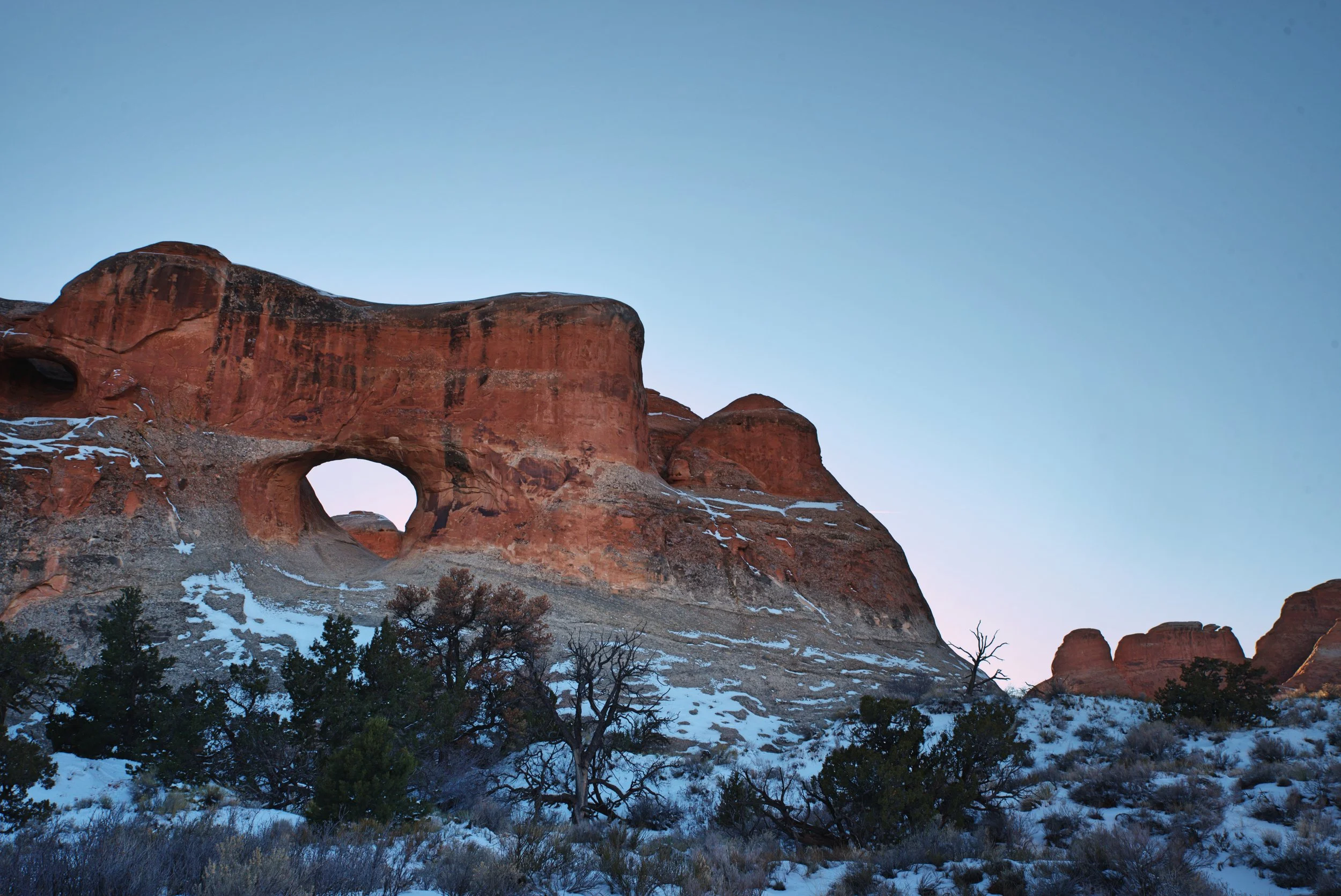
Early on the primitive trail make sure to look up to find a small arch called the “Top Story Window.” The window is high up on a long fin of sandstone, so the name really seems appropriate.

The Devils Garden trail is full of surprises like this sandstone pothole.
Private Arch
Soon after spotting the Top Story Window, we came to the half mile spur trail leading to Private Arch. Private Arch is hidden between two walls of stone and you look down on it from the viewpoint. It really is quite tucked away, and you’d likely never notice it if the map didn’t tell you it was there.
Continuing along the primitive trail beyond Private Arch, there are a lot of neat formations in the sandstone like hollowed out potholes carved by water. The final portion of the hike is easy, almost boring walking across the sandy open desert back to the developed trail to Landscape Arch.
Private Arch is tucked away below the viewpoint.

Surveying the stone in the Valley of the Fins.
Pine Tree and Tunnel Arch
We stopped at Pine Tree and Tunnel Arch on our way back to the van, since we had skipped them at the beginning of our hike. The spur trail to these arches is very short, so it’s a quick stop.
Pine Tree Arch is a large arch at ground level, and it’s definitely not one of the most breathtaking arches in Devils Garden. There is a sandy soil at its base so scrubby pinyons and junipers grow within Pine Tree Arch’s opening.
Pine Tree Arch is not the most stunning arch in Devils Garden.
Tunnel Arch was given its name because early visitors to the park thought it looked like a highway tunnel.
Tunnel Arch is in the middle of a rock wall, and it’s next to another smaller unnamed arch that we actually kind of thought was cooler. This type of arch begins forming when a puddle gathers on top of the rock. Eventually as the years pass, the water seeps in to the stone and carves a chute through the rock. Tunnel Arch itself kind of looks like a railway or highway tunnel. It’s very symmetrical with a curved top and straight sides.
For more on visiting Arches National Park in winter and our recommendations for free campsites, check out our blog posts “A Vanlife Guide to Arches National Park” and “Hiking to Delicate Arch in Winter.”
Posts Also Tagged:
ARCHES, ARCHES NATIONAL PARK, CANYONS, DARK ANGEL, DEVILS GARDEN, DOUBLE O ARCH, GEOLOGY, HIKING, LANDSCAPE ARCH, Moab, MOUNTAINS, NATIONAL PARKS, NATURAL BRIDGES, NAVAJO ARCH, PARTITION ARCH, PHOTOGRAPHY, PINE TREE ARCH, PRIVATE ARCH, PUBLIC LAND, TRAILS, TRAVEL, TUNNEL ARCH, UTAH, VANLIFE, WINTER TRAVEL
Have you hiked the Devils Garden Trail or visited Arches National Park? Leave a comment to tell us about your favorite spots!